> For the complete documentation index, see [llms.txt](https://accesstoland.gitbook.io/makingfarmlandwork/llms.txt). Markdown versions of documentation pages are available by appending `.md` to page URLs; this page is available as [Markdown](https://accesstoland.gitbook.io/makingfarmlandwork/practical-resources-to-get-started/surveying-and-decision-making-tools.md).
# Surveying and decision-making tools
### **Get basic information on a plot**
If you are organising a field survey or land watch action with volunteers, you can use the example below to create a basic land questionnaire for your surveyors to fill out.
#### **Summary sheet: realising a basic diagnosis of a plot (source: Terre de Liens Île-de-France)**
| Summary sheet |
| --------------------------------------------------------------------------------------------------------------------------------------------------------------------------------------------------------------------------------------------------------------------------------------------------------------------------------------------------------------------------------------------------------------------------------------------------------------------------------------------------------------------------- |
|
Date of the meeting
Location
Editor of the form (last name-first name-telephone)
|
|
Context of the land opportunity:
Background and description of the opportunity:
Is there a farmer currently farming this land? If so, how is it being farmed?
What are the owner's intentions (sell, lease, loan, keep as is...)
Is there a development project that threatens this opportunity?
|
|
Cadaster reference of the plots:
Section - n° of the plot - area (ha or acre) - zoning - owner
|
|
Immediate observations
Land configuration (divided, in one piece...):
State of the parcels (cultivated, fallow\...)
Historical use of the parcels
Observations of the soil (texture, color, presence of stones, compaction, depth, slope, geology)
Access to the plots
Access to water for irrigation (groundwater, surface water)
State of the building/Important work done or to be planned
|
|
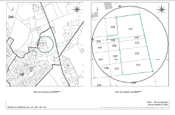
Plans and aerial photos
|
|
Socioeconomic environment
Demographics
Existence of CSA or short supply retailers in the area
Other: community groups, elected official likely to encourage the establishment of a farm, etc.
Natural or environmenal designation
Natura 2000, Park, Other?
Water zoning
Water catchment, innudation risk, other…
Other observations and analysis
|
### **Select projects to prioritise on public land**
Establishing criteria to decide to whom to lease out public land to is a key step. Below is a table for inspiration. The clearer your goals, the easier it will be to adapt criteria and scoring.
#### **Example of selection criteria to award public land** (sourced and adapted from: [Agrarwende konkrete. Wie wir die landnutzungglokal umgestalten](http://finc.de/oeffentliches-land-gestalten-agrarwende-konkret.html?file=files/Dokumente/AgrarWende_Konkret_2020_FINC.pdf). Concrete agricultural turnaround. How we transform land use locally.)
Criteria
Score
Organic farming (2 as a baseline, additional points for specifically regenerative techniques - permaculture, etc.)
Nb of people paid a living wage (one per person, up to 3 or 4)
1-3 points
Young farmers/new entrants
1 point
Solidarity farming
1 point
Regional marketing and value creation
1 point
Educational opportunities and inclusion
1 point
*Maximum number of points achievable: 12-15 points*
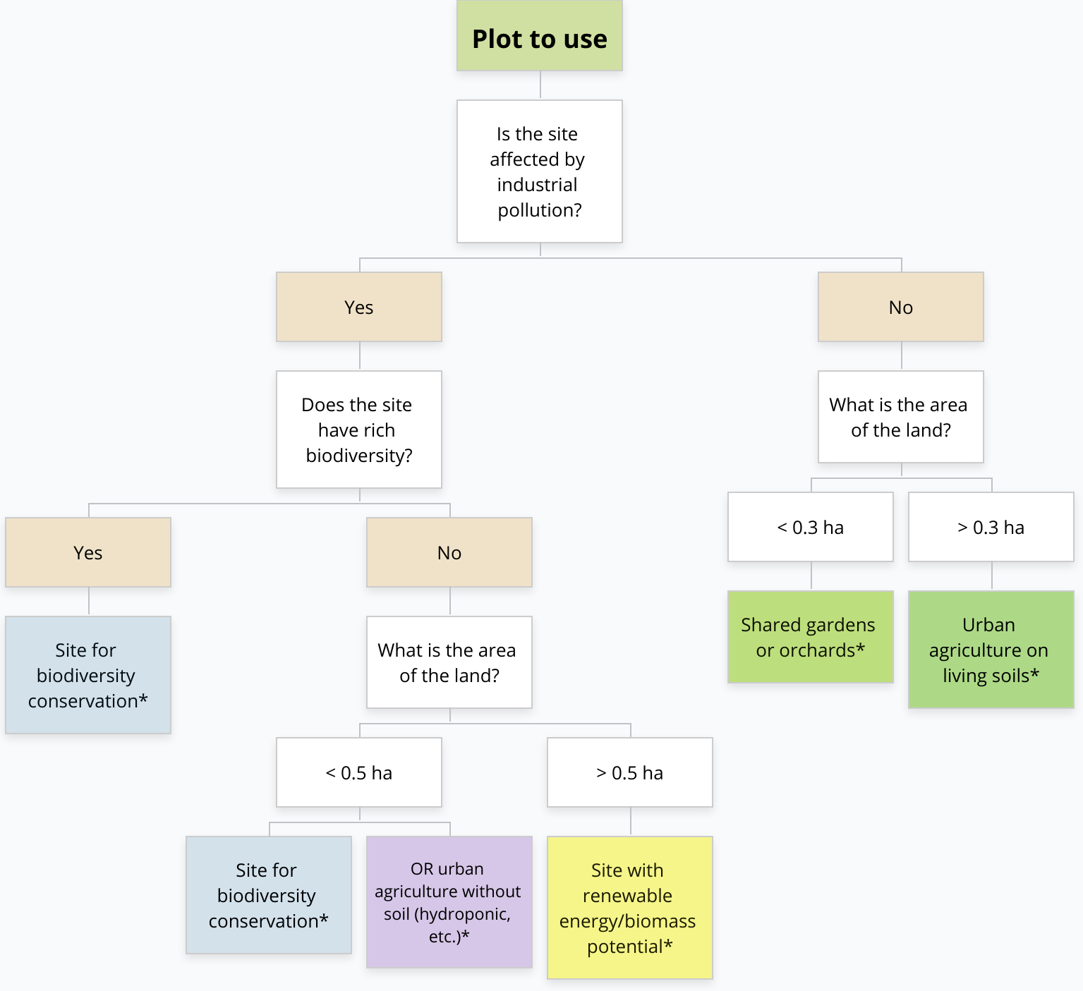
### **Decide what to do with public land plots**
Deciding on what use to make of the land identified through your surveys can be easier if you have developed clear tools, approved by elected officials and different departments within your local authority.
Below you will find an example of logic diagram developed by the city of Charleroi in Belgium to guide their decision-making processes regarding the use of specific plots. Charleroi’s issue is around the rehabilitation of polluted land (as the city’s economy has long relied on coal and steel industry). Once the plots have been inventoried, the logic diagram serves as a prioritising tool to decide on which parcels to act first.
Logic diagram developed by Charleroi to decide on use of public lands